Searching for Signs of Autumn While Hiking to Duke’s Creek Falls

Autumn seems to be taking its time this year, so I decided to look for change in the North Georgia Mountains in Helen, one of the region’s most captivating towns. And just outside of Helen, we find Duke’s Creek Falls.

Duke’s Creek Falls is popular for its proximity to  Helen and relative ease of hiking.  The trail is just over a mile and winds down the wall of a small gorge before meeting with and running alongside Duke’s Creek.

Small Hints of Fall Colors

One thing I love about the Duke’s Creek area is that I don’t have to go far to begin enjoying the views.  Mountains, including Mt. Yonah, adorn the landscape from an overlook right next to the restrooms.  Although a great view, I’m still seeing more green than any other color, though a few patches hint at a looming seasonal change.

Mount Yonah as seen from the parking lot for Duke's Creek Falls.

A view of Mt. Yonah from the parking lot of Duke’s Creek Falls

Honestly, I’m not complaining about the prolonged warm weather, even if it is the likely culprit for the late arrival of autumn colors. I’m also grateful for the lack of humidity.

The trail leading down to the Duke's Creek gorge

The trail down is to the right of the parking lot and remains pretty easy for the duration of my autumn hike. It’s only a mile long, so this definitely isn’t the place for those seeking a challenge.  A boardwalk leads to rugged trail which, shortly thereafter, leads to another boardwalk.

Boardwalk with some light fall foliage hanging above

From here, I get another great view of the mountains despite the persistently thick foliage.

Autumn leaves above an amazing mountain view

Deeper Into the Gorge

As I continue across the boardwalk, it gives way to rugged terrain again.  From here, I begin hearing the water below. Even as I descend down (slowly, given the nominal incline), the foliage remains green and thick.  However, I do see patches of color hinting at the still looming autumn season.  Temperatures still hover around the upper 70s and lower 80s. As I continue to descend, I come across some interesting trail features.

A tree seeming to grow out of a rock.

As the trail converges with Dukes Creek, I’m surprised that the water is flowing so well despite the persistent drought.  This is in contrast to many other spots throughout the region and certainly to my previous post covering Little River Canyon.  However, like last time, the air is still warm and fall colors have hardly begun to settle in.  So far, it looks like I may be in luck.  Even along the way, there were several others flowing just as well as they ever have.  However, I am surprised by the lack of fish in the clear waters.  This is especially surprising given the unseasonably warm temperatures.

Fallen leaves dot the rocks inside of Duke's Creek, which refuses to be halted by a drought.

Approaching Duke’s Creek Falls

Near the bottom, the trail twists to the right and once again becomes a boardwalk.  At this point, the falls begin coming into view.  I could see the water cascading down the mountainside through thick foliage that finally seemed more appropriate for the season.  A smaller, though more prominent, waterfall is found by back up the nearby staircase and to the left.  Needless to say, this spot is worth the 1.1 mile trek.

Falls colors surrunding Duke's Creek Falls

While a short hike for sure, it wasn’t bad for an early start to the weekend.  That evening would be spent exploring the streets of Helen.


First Autumn Hike of the Season: Little River Canyon, AL

For the first weekend of autumn, I decided to take a hike at the Little River Canyon National Preserve in Alabama.  It’s a little-known spot carved naturally into the state’s northeastern mountains.  Some believe its waterway, Little River, is the longest to flow over the top of a mountain.

Unfortunately, this hike was not without its difficulties.  The park’s map is poorly drafted, especially since it excludes roads.  Also, there are several streets in and near the preserve that are excessively steep and winding, sometimes simultaneously.  On one, my car was reaching 3 RPMs at 20 mph.  I didn’t even attempt another because it was actually steeper than the first. if you plan to visit, definitely start at the preserve’s northern section.

With autumn in its infancy, it still feels like summer outside.  As I get ready to hike, temperatures are comfortably in the low 90s, the sky is clear and humidity is high.  My GPS led me to the recreational area at the canyon’s mouth, the only park segment that requires paid parking.  Here, there are many picnic tables and grills.  There are also several spots that provide easy access to the river.  It’s was flowing nicely here, which I would later realize is a rare feature for today’s visit. If hiking is your goal, this probably isn’t the best place to start for reasons that will soon be explained.

The hiking trail begins at a partially closed gate.  The universal hiking man symbol marks its beginning.  It starts off partially paved, but quickly gives way to dirt.  The river is visible through the trees to my right, and subtrails occasionally branch out from the main one to offer access to swimming holes.  The trail is varied. Sometimes, it’s a simple dirt path. Other times, it becomes a rugged combination of ditches and rigid rocks.  The foliage is still thick and green, though hints of the looming autumn colors occasionally appear.

The start of the Johnnie's Creek Trail, the first trail of my autumn hikeEventually, the trail leads to the end of Johnnie’s Creek as it (normally) flows into Little River. Unfortunately, the creek is dry when today.  This is common for hikes in early autumn, but still kind of annoying.  Black rocks jut from the ground where water would normally flow, obviously making it easy to traverse the creek bed.  I can’t help but wonder what the rapids must look like when the creek is running.

A dry creek bed in Little River Canyon National Preserve

There wasn’t much else to see here, so I decided to head back.  The map revealed several more points of interest at the north end of the preserve, so I decided to drive up there.  Before making it back to my car, however, another group of hikers warned me of some copperhead snakes on the trail just ahead.

We approached the spot cautiously.  One was to our right, and a much larger one slithering on the rocks below to our left.  The one closer to the trail moved slowly and hesitantly, clearly cautious of our presence.  After the larger snake disappeared below the rocks, we decided to walk along the edge of the ravine and hope that neither would attack. Thankfully, they did not.

20160925_1340161

A copperhead snake greets me during my first autumn hike of the season.


After returning to my car, I attempted to follow the map to the north end of the park. Unfortunately, it shows one road where there are actually two, so I took a wrong turn up a hill that was both excessively steep and twisted.  My car was pushing 3rpms at 20mph, and for a few moments, I was honestly concerned that it wouldn’t make the incline.

Fortunately, this small side track wasn’t a complete waste.  The steep road dead ends at a highway, where I took a right. A little further down, there was a rough parking area next to another point of interest: a (supposed) waterfall.  Unfortunately, the creek was also running dry here, though a pool of water remained.  There are some unique rock formations here, and I couldn’t help but imagine what the waterfall would look like on such a beautiful fall day.

Rope Swing at Little River Canyon

A rope swing. How I wished I had brought a bathing suit…


After quickly exploring the features here, I head back to my car, get ready to travel further north – and run into a road even steeper than the last. Considering this one was actually even steeper, I knew my car wouldn’t make it. So, my only other option was to drive DOWN the previous hill and take a longer detour to the north side. Side note – if you visit this place, make sure your GPS is set to the visitor’s center.

Upon arriving at the north end of the park, I found that the roads were much easier to navigate.  I also noticed that the area was much better marked.  There are several points of interest relatively close together.  I stop by the visitor’s center for a few supplies and recommendations for my next hike.

The park ranger here recommended the Little River Falls trail.  This is arguably the most popular and also connects with the Martha’s Falls trail. It runs along the canyon’s rim as a boardwalk, then leads down to a pond of water and waterfall – which, of course, was dry.  Still, there were people swimming in the pond below.  As expected, Martha’s Falls was also dry.  However, there were some unique rock formations along the way that were definitely worth a visit.

The pool below Little River Falls which is running dry for my autumn hike

Some rock formations not far from Martha's Falls

Unfortunately, I had to cut my trip short due to the earlier woes of steep, winding hills.  The trails closed at dark, and it was already late in the afternoon.  I was also hoping to take an autumn hike in Desoto State Park while here, but that wouldn’t be possible either.  However, despite the persistently warm weather, I was still able to see some vestiges of fall color throughout the preserve and in the nearby mountains.  I also know where to go now if I ever have a chance to revisit.

Small hints of autumn color found during my hike

Emerging fall colors across a mountaintop


The Return of Autumn and Autumn Hiker

Autumn is back, and so is Autumn Hiker!  This blog has not been updated in a few years, but that’s about to change.  This time, it’ll be featuring more autumn hikes and fall foliage. I also plan to provide more useful information for autumn hiking, from tips to suggestions.  Best of all, there will be more creepy hikes this year in celebration of Halloween.  

Why make such a big deal about autumn hiking?  The weather is cooler, and nature offers its most vibrant colors to hikers.  It’s the perfect season for campfire stories, especially with Halloween right around the corner.  And best of all, most insects go into hibernation.

Join me as I enjoy some autumn hikes across the southeast, southwest, and possibly in a few surprise locations.  

Stick around. This season is going to be epic.

An Autumn Hike Through the Serpentine Barrens in Nottingham Park, PA

In the small town of Nottingham PA, there exists a unique park that offers visitors a chance to visit a rare ecosystem found only in this region: Nottingham Serpentine Barrens Park.  Rich in history and ecology, this Chester County attraction rests within a series of barrens that straddle the boundaries of Pennsylvania and Maryland.  The area is said to feature desert-like conditions due to the level of toxicity caused by unusually high amounts of metal in the soil, combined with a lack of nutrients.  As such, only a limited number of plants can grow in the area, some of which are found nowhere else in the world.  Due to the sunbaked nature of serpentine rock, such areas also typically boast warmer temperatures than the nearby region.

Upon entering, the park seemed anything but desert-like.  Tall trees, both pine and deciduous native throughout the area, were found in abundance just as they are across the northeast.  They also appeared to be at the peak of their fall colors, leading to anticipation for the coming autumn hike.  A small fenced area near the entrance offers visitors a preview of the serpentine grasses found throughout the area.

Entrance to Nottingham Park

After parking, a nearby map detailed the various trails found throughout Nottingham Park.  On the western side of the park, we discovered a little spot dubbed “The Mystery Hole.”  Unable to resist, we decided to begin our autumn hike at the Feldspar Trail leading to both it and the Buck Trail.

The trail system is surprisingly large for a county park.  We were led through forests and fields of serpentine grass with large creeks beside the trail.  Though the path occasionally featured large rocks or fairly deep (though easily avoided) holes, the trails were well maintained and easy to navigate.  The fall foliage seemed rather vibrant in some areas, but also very bare in others.  Along the way, various signs would provide information regarding the park’s history and ecology.  Apparently, some of the nearby areas were used for mining long before the importance of the local plant life was fully understood.  Remnants of old mining sites could still be found along the trails, the most impressive being the elusive mystery hole.

The mystery hole was actually a large pond area with rock walls rising above its banks.  Once a quarry, it now serves as a point of interest for visitors.  The area is surrounded by a fence, blocking access and inhibiting the ability to take pictures.  Some large rocks nearby could have provided relatively easy access over the fence, but I’m not one to risk jail time.  The fall colors reflecting from the lake still made for a serene setting, and I was able to catch a few shots through the fence of the area.

Nottingham Barrens Mystery Hole during Fall

Autumn leaves reaching over the Nottingham Park “mystery hole” quarry site.

Other than the quarry sites, the environment didn’t seem very different from those found throughout the northeast, though the fall colors still made for a great autumn hike.  The serpentine grass largely resembled overgrown grass found in any field, though I’m not sure how it would look during the spring or summer.  And, to be fair, we only covered a small section of the entire park.

Field of Serpentine Grass During Autumn

A field of serpentine grass with fall foliage rising in the distance.

A Quick Autumn Hike Along an Extended Road Trip

As much as I love road trips, there’s something about driving several hours and knowing you still have several more to go that makes you want to spend a little less time behind the wheel and a little more time exercising.  Add the incredible mountain views along Interstate 81 in western Virginia, and I soon found myself unable to sit down any longer.  I decided to get off at the next state park for an unexpected autumn hike and soon found myself at Claytor Lake.

Nestled in the Appalachian Foothills, Claytor Lake State Park provides a great afternoon getaway with fun for the whole family.  While not among Virginia’s most unique parks (as the state’s are voted best in the nation), it still offers a little outdoor tranquility for a weekend out.  Hiking, biking, boating, and fishing are all available to visitors, along with a host of other activities.  The Historic Howe house also offers exhibits describing the park’s history and natural features. 

Since I still had several hours of driving left ahead, I decided to just stop in for a quick autumn hike.  The Claytor Lake Trail was closest to the entrance and offered a great view of the lake.  Right from the start of my quick autumn hike, I noticed that the trees seemed unusually bare, with a thick layer of leaves covering the forest floor.  It seemed strange given the time of year, but I would later find possible clues as to why. 

The Start of the Claytor Lake Hiking Trail

The Trailhead for Claytor Lake

I had to pay close attention to the map as I continued hiking, since the thick cover of leaves made navigating the trail difficult.  Unfortunately, the area was mostly wooded and offered limited natural reference points to guide my way.  One of those few that did exist was a rather large open field, the rim of which marked a curve in the trail.  Some of the nearby trees were less bare in this area, allowing me to enjoy a quick break from the mostly gray, barren foliage surrounding me.  Beyond the clearing, I allowed the blue trail markers to lead me on.

Autumn leaves covering a hiking trail

Trail covered by a thick layer of fallen leaves

Continuing ahead, I came across a few surprisingly steep hills.  Every trail in the park received an easy rating on the map, so the change in terrain was rather unexpected.  Soon after, however, I found clues as to why the trees seemed unusually bare; I came across a section of forest that seemed to have suffered significant damage from a possible recent storm.  Most of the trees were without branches, and several (including a rather large one) had toppled over.  The light breeze sounded unusually loud in this area, reminding me of a few past breezy hikes through the desert.  Some nearby trailers confirmed that I was still on track for my quick autumn hike, so I continued along the trail. 

Damaged trees in Claytor State Park

Possible storm damage in Claytor Lake State Park

Shortly thereafter, I began to catch glimpses of Claytor Lake, foothills rising above its bank on the other side.  It was a serene setting despite the numerous trees partially obscuring my view, but the trail soon curved around the back of a hill.  With the lake out of site, I continued up and down more steep hills before seeing a whitetail dove running near the trail.  Sadly, I was unable to pull out my camera in time to capture it. 

A little ways further, I began to catch glimpses of the lake again, this time with a thinning tree line.  The trees soon gave way to a full clearing, one that featured cabins, docks, and, of course, an unobscured view of the lake and foothills.  The lake seemed to stretch on for miles, which I found fitting given that it’s nearly 10 times larger than the park.  My quick autumn hike had yielded some rather impressive views, and I took a moment to enjoy the serenity before rushing back to the car to finish my trip. 


Cloudland Canyon: An Autumn Hike into Georgia’s Best Kept Secret

Before heading up north, I decided to take an autumn hike in one of the south’s top obscure attractions: Cloudland Canyon.

Despite the many activities that have made Lookout Mountain famous, most residents in the region seem unaware of the unique canyon it forms in northwestern Georgia.  It features unique rock formations and lush plant life, both offering incredible views during fall.  The park also offers visitors hiking, biking, and back country trails, as well as a variety of accommodations for extended stay.

The entrance to Cloudland Canyon actually rests on top of Lookout Mountain.  Visitors are able to visit a nice park area featuring picnic tables, vending machines, an educational area, and breathtaking views, all without the necessity for a strenuous hike.  I also found this an interesting start for my autumn hike.  At its higher elevation, the park offered more vibrant fall colors than those found in the canyon below.  Various signs offered descriptions of the local plant and animal life.  I was surprised to find that flying squirrels were native to this area, though they are also (and unfortunately) nocturnal.  Overlooks to the north and west offered views of different sections within the canyon and the fall foliage that was beginning to break through the rock formations.  However, it was the canyon floor that was particularly curious.  Looking down, it seemed that only trees lined the bottom.  Yet the sounds of crashing water revealed a clue to the world that would be revealed after descending.

Fall Colors on the western wall of Cloudland Canyon

A view of of the western wall of Cloudland Canyon, featuring colorful fall foliage.

From the park at the north end, a trail leads visitors down the side of the canyon.  The descent quickly offers clues to the hidden treasures below.  Unique, ancient rock formations line the path, offering a look at the local geological history and even a few resting spots.  Small streams of water can also be found along the trail.

Cloudland Canyon Trailhead

The trailhead leading down the eastern wall of Cloudland Canyon

As I descended the many staircases and stone paths, I began to see the difference in fall foliage between the higher and lower elevations. There appeared to be a definable line between the end of fall colors and the beginning of thicker, greener flora.  In addition to capturing this line, I also wanted to take more pictures of the stairways so others could know what to expect.  This, however, was a particularly crowded day.  I prefer to respect the privacy of others, and was limited to capturing pictures on the few empty clearings available.

Cloudland Canyon Staircase

One of the many staircases leading to the bottom of Cloudland Canyon

About halfway down, the trail splits to the left or right.  The trail to the right continues my journey to the canyon floor, while the one to the left provides access to the west side of the canyon.  I decided to head over there first and see how the canyon looked from the other side.  Along the way, I soon found that Cloudland Canyon is easily home to some of the rockiest trails I have ever encountered.  This is particularly cumbersome during an autumn hike, as even a thin layer of fallen leaves will easily conceal prominent and sharp rocks.  I had to choose my steps carefully, especially as the path began to narrow.

Cloudland Canyon's rocky terrain

Some of the rocky terrain that comes with a hike through Cloudland Canyon’s Trails

The south side of the canyon actually flattens to some extent, making access to the other side surprisingly easy.  A small wooden bridge completes the link, and I soon found myself on the western wall.  The path became increasingly narrow and steep as I continued my autumn hike into this new area.  I also noticed a significant thinning in the crowds and soon found myself alone on the trail.  As I continued hiking upward, I found some interesting rock formations, including one with small streams of water flowing from above.

Cloudland Canyon rock formation

A rock formation along the western wall of Cloudland Canyon that features small streams of water

The path beyond this formation looked treacherous (and may not have even been a trail at all).  Though I wanted to see the view from the other side, I decided to just drive there later and headed back to the original trail.  I continued along past the split and was soon greeted by a rather large rock outcropping with a stone bench tucked underneath.  Naturally, the bench was crowded with daring hikers, so I continued down the steep stairway.

Jutting boulder at Cloudland Canyon

If you dare, you can relax on a stone bench placed under this massive boulder.

By the time I reached the canyon floor, the trees and shrubbery largely resembled those found during summer.  Tucked underneath the fall leaves, however, was a world that shattered expectations.  A large creek flowed quickly through an abundance of rock formations, and the nearby sounds of falling water promised multiple waterfalls.  And it was all hidden from the higher views by a thick canopy of trees.   There were many new sights to see, as my autumn hike had only just begun.  I was greeted by a sign offering a view of the Cherokee falls to the left or Hemlock falls to the right.  Given the loud shouts of a few (likely) drunken people to the left, I decided to head for Hemlock Falls.

This is actually a park that I have visited once before, and as I neared Hemlock Falls, disappointment began to set in.  The raging river that flowed through this canyon during the summer had trickled down to a creek.  I could easily make out the areas once covered with water that now boasted sharp rocks.  I had a feeling this would hinder the majesty of the waterfalls I had seen earlier this year.  After taking the semi-transparent bridge over Daniel Creek, I descended a path leading around Hemlock Falls, where my suspicions were confirmed: the waterfall was, indeed, significantly smaller.  This, unfortunately, is a downside to any autumn hike, as many tributaries, creeks, and rivers seem to diminish, sometimes completely.

Hemlock Falls in Cloudland Canyon

What’s left of Hemlock Falls in Cloudland Canyon. Sadly, my camera doesn’t do such a great job of taking waterfall shots.

Despite my disappointment, I still veered off of the trail (and broke an important safety rule) to get a closer view of what was left of the waterfall.  I had to climb down a steep embankment, relying on the gnarly roots of a nearby tree for support.  At the bottom, I found large stones jutting out of the water, providing convenient access from nearly any angle.  I was able to get surprisingly close, inhibited only by slippery rocks and the threat of getting soaked in the midst of cool temperatures.

Back on the path, the Waterfall trail connects with Sittons Gulch to the north.  This trail offers autumn hikers a view of a much smaller waterfall that forms from the rock infested pool of Hemlock Falls.  Unfortunately, this once vibrant waterfall had diminished to barely a trickle.  It left little hope as I continued on my way to Sittons Gulch falls, which was also significantly reduced.  However, by the time I reached this waterfall, a familiar occurrence began to take shape.  Despite the Weather Channel’s promise of no rain, I began to feel light drops while observing what remained of the nearby falls.  It served as a disappointing reminder of my last shortened autumn hike at Fort Mountain, but I still persisted on my way to see Cherokee falls before ending my autumn hike.

Cherokee Falls in Cloudland Canyon

What’s left of Cherokee Falls with fall foliage across the top.

When I reached the intersection between the two falls and the main trail, the shouting at Cherokee Falls seemed to have ceased.  This was confirmed as I made my way around the mountainside and through a wooded area, though my anticipation for disappointment was not disappointed.  Cherokee falls, despite its height, was still reduced to a trickle, though the fall foliage just above still made for a serene setting.  Unfortunately, the precipitation became heavier, leading me to once again end an autumn hike early.  By the time I finished my ascent to the top, the weather had given way to a full-blown rain storm.  Fortunately, the thick forest canopy shielded me from most of the rain heading up, so I wasn’t too wet by the time I returned to my car.

Cloudland Canyon rainstorm

Rain sweeping through Cloudland Canyon, cutting my autumn hike short.

Comparative shots of the waterfalls can be found in the gallery.

Fort Mountain: An Autumn Hike on the Sentinel of the Appalachians

As my trek down south continues, I decided to take another autumn hike at Fort Mountain State Park.  Located just outside the small town of Chatsworth, Fort Mountain is a unique park that features a history as rich as its luscious fall foliage.  The fall leaves have turned to even more brilliant colors than those of my last hike, and the weather is much cooler at this higher-altitude park. Fort Mountain offers the highest point of the Cohutta Mountains, a small range near the southern tip of the Appalachians.  It is on this mountain that visitors will find a summit with a rich historical value shrouded in mystery.

Fort Mountain is named after a series of rocks leading up to the peak that appear to have been arranged as a defensive barrier.  Experts have yet to agree on the origins of the stone wall.  Some are convinced that it was built by Native Americans, while others claim it was conceived by European explorers.  There are also those who believe the occurrence is completely natural and its arrangement a coincidence.  Even experts that agree on it being man made remain at odds about what they were protecting themselves from.

Personally, I believe it was this ghost tree I found standing watch over the hiking trail. It seemed eerily reminiscent of the coming Halloween holiday.

Regardless of its true origins, the rocks were the inspiration for the construction of the nearby stone fire tower, a project meant to enhance the mountain’s historical value and the local economy through the Civilian Conservation Corps as part of the historic New Deal.  Built upon the mountain’s highest summit, it certainly suits its purpose as a fortified watchtower for the nearby barrier.

Fort Mountain State Park’s boundaries begin long after the road starts climbing.  The mountain pass leading up to the park’s gates offers excellent views of unique fall foliage and the nearby mountains.  The drive certainly succeeded in building anticipation for the coming autumn hike.  The fall colors became more vibrant as I climbed higher, and the nearby mountains reached towards the low hanging clouds along the side of the road.

A mountain pass leading to the Fort Mountain State Park

The mountain pass leading up to Fort Mountain State Park

Rugged mountains as seen from Fort Mountain

Peering through the fall foliage to the nearby mountains


After driving into the park, I grabbed a map from the ranger station to plan my route.  The trails to the north quickly drew my attention, as they led to the Stone Wall, tower, and overlooks.  The Cool Springs Overlook trail seemed the best place to start, as it connected with the loop, a trail that circled the top of the mountain and provided access to all other nearby trails.

Cool Springs Overlook Trail Head

Cool Springs Overlook Trail Head


I found a viewing platform just a short walk away from the Cool Springs Overlook trail head.  While the overlook failed to reveal any nearby springs, it did offer another incredible view of the mountains.  This is one of the best aspects of an autumn hike, as the fall foliage revealed vibrant colors across the landscape.  I found the trail leading up the overlook to be mostly straightforward, though it did offer periodic challenges, including some that were difficult to spot until coming dangerously close.

Just past the overlook, the smaller trail led up to the loop.  Right before connecting with the loop, however, I found myself crossing a small, now mostly dry creek (small enough to step over).  The trail then cut to the northeast and began leading me to the Stone Wall Trail.  While hiking, I noticed some rather large piles of rocks stretching up the side of the mountain.  These offered a little more credence to the notion of a natural occurrence.   A little closer to the Stone Rock Trail, I noticed a layer of deep mud and some water stretching across the path.  This would have been enough to abruptly end my hike, but I noticed a small (though more technical) side-path that led around the puddle.  I had to climb a fairly steep (though relatively short) incline to reach it, one that was partially hidden behind a boulder.

As I traveled higher up the trail, I began to feel what seemed to be small drops of precipitation.  I became concerned, as the temperatures were ranging between the low 40s and upper 50s, and I had not brought an umbrella with me.  Still, the forecast had promised a 0% chance of rain, so I decided to take the chance and carry on.

While hiking the loop, through the tufts of autumn leaves, I could make out the outlines of the Cahutta Mountain range.  Even though my autumn hike started up higher on the mountain, I was surprised to see just how much I had already climbed since my initial view from the overlook.  The loop soon connected with the Stone Wall Trail, providing rugged access to the very site that made this mountain famous.  As I had not yet viewed any pictures of the wall, I really wasn’t sure what I would find.

IMAG0055


Call it ruins or a formation, the Stone Wall wasn’t quite what I expected.  In fact, I didn’t even realize that I had stumbled across it until the autumn leaves cleared and revealed a granite tablet in the midst of a cascading pile of rocks.  The tablet provided some historical information regarding the mountain, the wall, and the stone monument just ahead.  The information had faded after years of weathering, and I imagine the state park service will need to revamp it soon before it fades to the point of illegibility.

Past the tablet, the trail curves up towards the stone tower.  Steps composed of rocks lead the way, making for a hike that’s easier on the ankles but harder on the knees.  It is actually at the top of this trail that visitors will find the mountain’s summit, and atop it, the stone tower (many descriptions of the mountain claim that the rock wall is found at the mountain’s highest point).  By the time I reached the tower, the small drops I felt earlier had given way to a lightly falling mist, increasing my concerns of eventually getting soaked in the cool fall weather.  Thankfully, the lower section of the tower is open to visitors, so I decided to seek shelter inside, hoping to wait out any possible rain.

After the mist cleared, I headed west and down a series of stairs towards the next overlook.  This one provides an excellent view of Chatsworth, GA, though thick clouds obscured the mountains across the valley.  The mountain to the north revealed just how low the clouds were hanging, as its peak was just reaching into them from a summit not much higher than the one on which I stood.  To the south, the curves of the nearby mountainside provided a clear view of its stunning fall foliage, while the mountain just beyond remained partially hazy.  It made for a somewhat surreal view.


As I headed back towards the summit, the mist began falling again, a bit thicker this time.  Even though there were more trails to explore, I didn’t want to take any more chances and decided to end my hike early.  I wasn’t too disappointed though, as I had already hiked some amazing trails and still had one last view from the eastern overlook.  This time, the wind was blowing a cloud just over another mountain’s summit, causing it to part ways almost like smoke, but with almost a magical touch to it.  I had never seen such a sight before, but it was one that will certainly end any future hesitations of hiking on a cloudy day.


A Humble Start to an Autumn Adventure

It seems that I’ll be spending some time down south during the beginning of fall, so for my first autumn hike, I decided to visit a humble spot within the North Georgia Mountains: James H. Sloppy Floyd State Park. Situated at the base of Taylor Ridge, Floyd Park is a unique spot that truly offers something for everyone.  The park was named in honor of a state politician that served just over two decades.

After driving into the park’s boundaries via a road of the same name, James H. Sloppy Floyd State Park immediately offers excellent lakeside views, complete with lush vegetation and camping spots.  The mountain peaks of Taylor Ridge rise just above, creating a unique picturesque setting.  Fishing is available to license holders in a variety of locations, including a walking bridge that stretches across one of the lakes.  Kayak and pedal boat rentals are also available, though they appeared to be out of season.

Taylor Ridge rising over a nearby lake

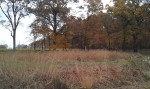
Of course, I came here to enjoy an autumn hike, so the park’s trails are my destination.  It features four in all: two easy trails circling around the lakes, a moderate trail that takes visitors past the marble mine and up to the summit of Taylor Ridge, and a rigorous trail that also scales the nearby mountain.  Each of the more challenging trails also connect with the Pinhoti National Recreation Trail.  After reviewing the map, I noticed that the upper lake trail crosses over the north lake before connecting with the Marble trail, so I decided to set this as my course. Despite visiting in mid-October, it still felt more like a summer hike that autumn.  Green, luscious trees and foliage surrounded me, and the local high reached into the lower 80s.  Still, the air was relatively dry (given Georgia’s infamously high levels of humidity), and patches of autumn colors could be seen breaking through the landscape.

A patch of autumn foliage within a still mostly green forest

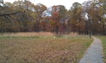
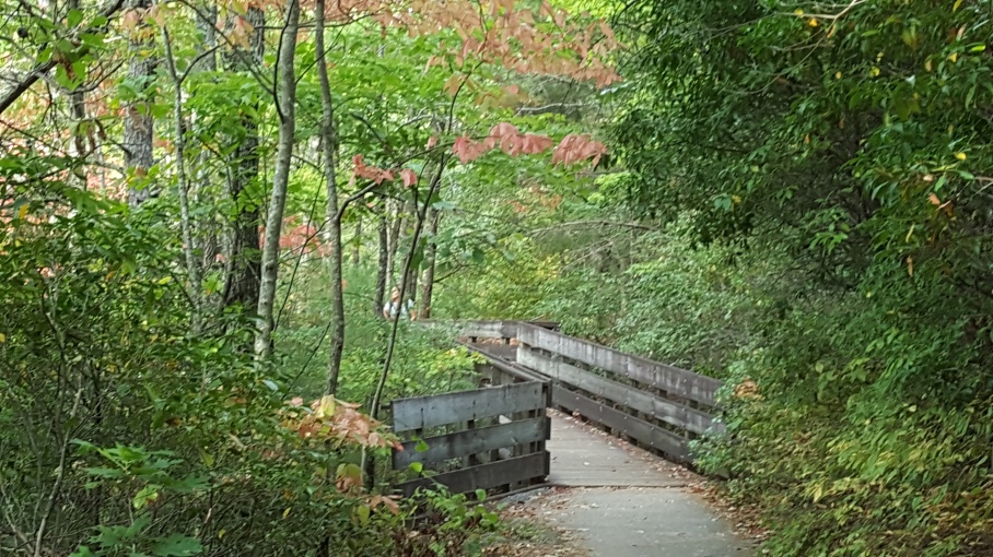
I began my hike by setting out on a walking bridge that crossed the upper lake.  A few parents were teaching their children how to fish, and the available catches seemed plentiful for the catch  After  crossing over the Upper Lake, the trailed passed by a scenic picnic area before shifting into the woods.  Shortly after entering the forest, I noticed a side trail cutting to the left.  Since the map had identified this as the connector to the marble mine trail, I decided to take it. Not long after, I came across an intersection with another trail.  I didn’t remember seeing this on the map, so I reached to pull it out and confirm my route- only to realize that I had left it in my car.  Not the most ideal of circumstances, but I was feeling adventurous, and didn’t really feel like going back to my car anyway.  So, I pressed on.

The semi-rugged trail leading to marble mine

Marble Mine Trail is classified as moderate, and it’s easy to see why.  The path is anything but flat, and can become somewhat rugged at times.  Still, I found that by stepping carefully and looking to the trail ahead, I could easily avoid the most strenuous terrain by sticking to the side.  The surrounding woods still seemed like more of a summer than autumn hike (minus the humidity), but the change was becoming evident.  I actually found more fall colors scattered across the ground than I did in the trees and brush.

One aspect of hiking I have learned is that distance seems much more varied within a thick forest landscape than walking in the city or even a flat, paved path (especially when you forget to bring the map).  I was eager to see the geological wonder that is the marble mine’s reflecting pool (only .7 miles according to the last sign), but my trek seemed to be taking much longer than that.  I began to consider searching for an online map with my Android phone despite limited, slow service, when a rather creepy looking dark area suddenly appeared on the path ahead.  The sun’s sun’s light was illuminating my surroundings quite well despite the thick branches above, yet this particular area appeared dark as night.

The darkness of the marble mine ahead

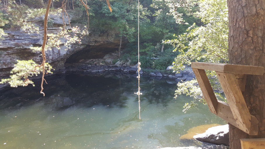
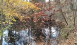
I inched closer until I heard the sound of falling water.  I picked up the pace a little faster and discovered that my autumn hike had finally led me to the very geological structure that made this park famous: the Marble Mine Reflecting Pool.  I found it a rather unique site for the trail I had traversed so far.  A thin waterfall cascades over the top of the cave and lands gently into the small pool of water below.  Behind that, a wooden walkway leads deeper inside. I tried snapping a few photos of the cave, but the sun just happened to be in the perfect spot to ruin my chance.  You can see the result below.

Marble Mine in James H. Sloppy Floyd State Park

Once inside, I found some interesting geological formations reminiscent of a beginner rock climber’s dreams come true.  The rocky walls were rather jagged, leading up to a surprisingly smooth ceiling.  Small streams of water leaked in various areas across the top, falling in seemingly random spots below.  It reminded me of the Tonto Natural Bridge in Arizona, except much smaller.

After following the pathway to the left, it ended just before a cave that appeared to go much deeper into Taylor Ridge.  Unfortunately, exploring it would have required climbing some rather slippery rocks and moving past the barricade set by park rangers.  Despite my love for adventure, I wasn’t interested in taking any unnecessary risks, rather it be personal injury or arrest.

A deeper tunnel leading into the marble mine

The rocky walls of the marble mine

Marble Mine Waterfall in James H. Sloppy Floyd State Park

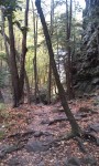
After visiting the marble mine, I decided to scale the nearby mountain.  A trail to my right led the way, soon leading me up a steep hill before cutting back to the left and up Taylor Ridge.  I’ve often been told that autumn leaves begin turning at higher elevations, and I was curious if there was any real difference between the base and summit.  When trekking the mountain trial, I did notice that it, as expected, becomes a bit more strenuous, as there are more steep inclines.  As I climbed the first of many steep hills, I suddenly heard a gunshot from my right.  I was startled, but then remembered that it was hunting season in the nearby Chattahoochee Forest Wildlife Management area.  I still thought the shot was fairly loud given the foothills separating me from the hunters (and any stray bullets), but continued to press on without concern.  A few more shots echoed through the forest, and then silence as I continued higher up the mountain.

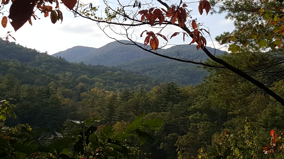
As is often the case when hiking through a heavily forested area, I found it difficult to tell how high I was climbing as the trail led upward.  The ascent didn’t seem too drastic until a small clearing to my left revealed the mountainous valley below.  Indeed, I had already climbed quite a distance.  I could see mountains surrounding a large area below, including the park where my autumn hike began.  Of course, I was only able to catch glimpses, as the thick foliage blocked most of my view.

Unfortunately, my camera was able to capture even less of the limited view.  I suppose it’s true that no camera will ever be able to match the human eye’s ability to capture the true majesty of an awesome outdoor view (or perhaps I just need a new camera).  I did, however, at least manage to capture this shot.

View of a North Georgia mountain valley from Taylor Ridge

As I neared the summit, I came across some unique plant life, the leaves of which were offering a glimpse of the autumn season.

Partially changed autumn leaves

A plan featuring autumn colors and berries

Other than these small plants though, the foliage at this higher altitude still reflected the mostly summer-time colors of those below.

After reaching the summit, I was glad to see that I had finally connected with the famous Pinhoti Trail, a 335 mile hike highlighting some of the southeast’s finest mountainous regions.  It provides an excellent opportunity for adventurers to practice their long-distance hiking know-how for the Appalachian Trail (which it also connects with).  It stretches from North Georgia to Flagg mountain in Alabama, the southern-most portion of the Appalachian trail with a summit that exceeds 1000 feet.  Unfortunately, I won’t have enough free time for such a journey anytime soon, so I decided to turn back towards the park after walking only a short distance on the Pinhoti.

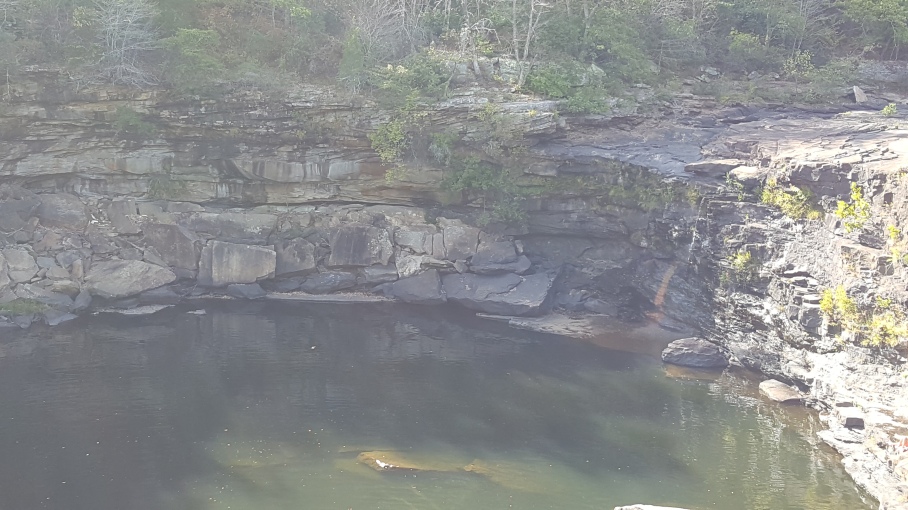
Despite my earlier hesitance for the sake of safety, I found that I couldn’t completely suppress my sense of adventure after revisiting the marble mine.  Although technically off the trail, there were no signs barring visitors from walking up the hill next to the reflecting pool to the top of the cave.  So, after checking to ensure that the coast was clear, I decided to see how it looked from above.  The hill leading up and around the mine was fairly steep, and I found myself using some of the smaller trees for stability more than once.  I was surprised to discover just how small the creek feeding the waterfall was, given its width upon landing.

The top of Jame H Sloppy Floyd State Park's Marble Mine

I then set out to conclude my autumn hike, followed by some time relaxing near the lakes and enjoying what few fall colors were available.  Near the end of the trail, I took a moment to look back at the sheer distance between the trail head and the mountain’s peak.  It’s always an amazing feeling to know that you conquered something like that, not with the help of a car, ATV, or even bicycle, but completely of your own effort.

Taylor Ridge in the distance from James H. Floyd Sloppy State Park during Autumn

I took the opportunity to relax by the lake before ending my early-autumn adventure and heading out.

Foothill rising above autumn foilage in James H Sloppy Floyd State Park

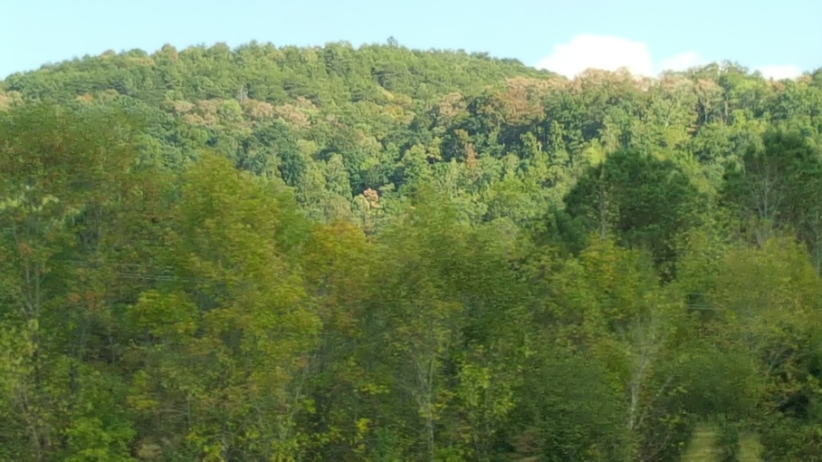
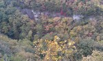
This foothill rises just over the autumn foliage across the lake from Taylor Ridge.

James Floyd State Park provided a modestly refreshing start to my autumn hiking adventure, though granted one that also offered a surprising level of adventure.  It looks like my visit down south will continue through this region’s peak season, which could mean some rather bland hikes when I head up north.  Even so, I will make the best of it.

I would like to mention that while I did experience an enjoyable hike without it, I never recommend anyone else to hike in an unfamiliar area without a map.  This is especially true for autumn hiking excursions, as a large volume of leaves can easily cover across the trail and forest floor, making it difficult to tell if where the trail may be turning.  If you are not carefully, you could very easily veer off of the trail and become lost in an area with scarce cell phone reception.
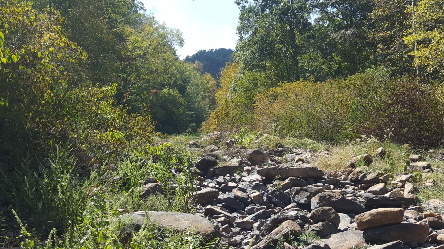